Proceedings
The 2001 UNC Sometimes Annual Phytogeographical Excursion
to
West Texas
March 9-18, 2001
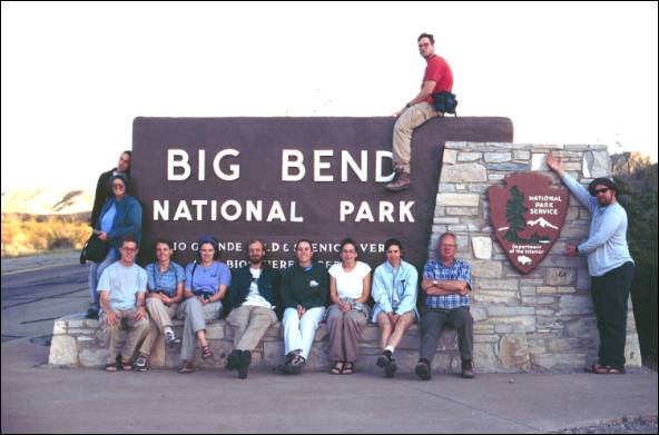
Participants (counterclockwise from high noon): Jason Fridley, Rob McDonald, Pat Corry, Andy Gerschutz, Becky Brown, Michelle Cawley, Dane Kuppinger, Andrea Jones, Jessica Kaplan, Laura Phillips, Bob Peet, David Vandermast, & Molly Nixon (photographer).
Itinerary
March 9 – Friday The long drive. Depart: Coker Hall 6:30 am;
Route: I-40 w to I-85; I-65 w to Montgomery AL, I-65 s to Mobile AL, I-10 w to San Antonio TX.
March 10 – Saturday The Rio
Grande Valley
Route: US-90 w to Marathon, arrive ca 6:00 pm
Lodging: Marathon Motel, Marathon TX.
Meals: Breakfast at Denny’s in San Antonio, Dinner at the Dry Bean Restaurant, Marathon TX
10-1 Dunlay roadside
10-3 Amistad National Recreation Area
10-4 Pecos River Bridge wayside
March 11 – Sunday Eastern
Big Bend National Park
Route: TX 385 s to Visitors Center, se to Boquillas Canyon, return to Visitors Center, w to Study Butte TX immediately outside park.
Lodging: Campground at Big Bend Motor Inn, Study Butte TX (~ Terlingua TX)
11-1 Lupineland
11-2 Rock-nettle Cascades
11-3 Boquillas Overlook
11-4 Boquillas Canyon
11-5 Old Ore Road
11-6 Larrea wash
11-7 The lupine line
11-8 Panther Junction flower fields
March 12 – Monday The High
Chisos
Route:TX-118 e to Green Gulch Road, s to termination at the Visitor’s Center, return same route.
Lodging: Campground at Big Bend Motor Inn, Study Butte TX
12-2 Laguna Meadows
12-3 South Rim
12-4 Upper Boot Canyon
12-5 Middle Boot Canyon
12-6 The descent
March 13 – Tuesday Western Big Bend National Park
Route:118 e to Ross Maxwell Scenic Drive, s to end of road at Santa Elena Canyon, return same route with stops along the way.
Lodging: Campground at Big Bend Motor Inn, Study Butte TX
13-1 Ross Maxwell scenic drive
13-2 Santa Elena Canyon
13-3 Tuff Canyon
13-4 Mule Ears Peaks
13-5 Sotol Vista
13-6 Cattail Falls
March 14 – Wednesday Northern Big
Bend
Route: Tx-118 e to Green Gulch Road, s to Old Mine Trailhead at lip of Basin. Return to 118, and continue e to US-385, n to Dagger Flat Auto Trail, e to end of road, return to US-385, s to Panther Junction, w to Grapevine Hills Road, n to trailhead, s to 118, w to Terlingua, n to Alpine.
Lodging: Motel Bien Venido, Alpine Texas
Dinner: Pizza Hut, Alpine TX
14-1 Lost Mine Trail
14-3 Purple Larrea flats
14-4 Dagger Flats
14-5 Basalt Ridge
14-6 Grapevine Hills
March 15 – Thursday Carlsbad
Caverns
Route:US-90 w to Van Horn, TX-54 n to US-62, s (=w) on 62 ca 5 mi to salt flats. N (= e) on 62 to Whites City NM, e on Carlsbad access road to visitors center. Return to Whites City, US 62 s to Guadalupe Mountains NP visitor’s center and campground.
Lodging: Guadalupe Mountains N.P. Campground
15-1 Salt Basin
15-2 Hypogean habitats and cavernicolous creatures
15-3
Sotol grasslands, northern flavor
March 16 – Friday McKittrick Canyon
Route: ca 8 mi ne on US-62 to McKittrick Canyon access road. Ca 4 mi west to trail head. Return to campgroup to pack.
Lodging: On the road again
Dinner: Odessa TX
16-1 Campground woodlands
16-2 Trail to McKittrick Canyon
16-4 Canyon bottoms
16-5 Canyon head
March 17 – Saturday The other long drive
Route: US-180 n, TX-652 e, US-285 s to Peco, I-20 e to Dallas TX, I-30 e to Little Rock AR, I-40 e Lebanon TN. US-231 s to Cedars of Lebanon State Park (Stop 17-1). US-231 n to I-40, I-40 e to Chapel Hill NC, arriving ca 3:00 am.
Meals: Breakfast in Arkadelphia AR, Lunch I Memphis TN, Dinner in Lebanon TN.
17-1 Cedars of Lebanon State Park